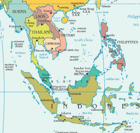
 Singapore is in SE Asia located at the bottom tip of Malaysia (land in white in top photo) and above Indonesia. It is very small, 14 miles x 27 miles and has 5.3 million people. See the map below for its location in the region (you can see the name, but the country doesn’t actually appear on the map).
It is very near the equator (1 degree North, holy crap!) which makes for equal hours of light each day with the sun rising at 7 am and setting at 7 pm every day of the year. The temperature varies slightly each day with an average temp of 87 degrees with the heat index that makes it feel more or less than 87 (according to me); low – mid 90’s are pretty common in mid-day. There are downpours probably every other day that don’t last long and often make it less hot and probably more humid. I am finding this moist heat and somewhat overcast skies much easier to be in each day than dry, intense heat like our south or southwest.
A city state (Singapore, Singapore is the only city and also the country) was founded as a British trading colony in 1819. It has a Parliament, and a number of embassies. We are frequently asked about its language. Since its British origins, the language of business is English, however, many people speak their native languages even young people. Other countries of origin include include China, Philippines, Korea, Vietnam, and India.
Singapore joined the Malaysian Federation in 1963 but separated two years later and became independent. It subsequently became one of the world’s most prosperous countries with strong international trading links (its port is one of the world’s busiest in terms of tonnage handled) and with per capita GDP equal to that of the leading nations of Western Europe.
Singapore is a hub for air travel and shopping, and has a great reputation of being very clean and safe.